
Caleta Tortel is a car-free Patagonian village built on cypress boardwalks, where small expedition ships anchor and tender you to a wooden wharf. There are no roads, no terminal and no ATMs. You come here to walk the boardwalks, meet a small isolated community, and watch the weather. Bring pesos, grippy waterproof shoes and realistic expectations.
Quick Facts for Your Caleta Tortel Visit
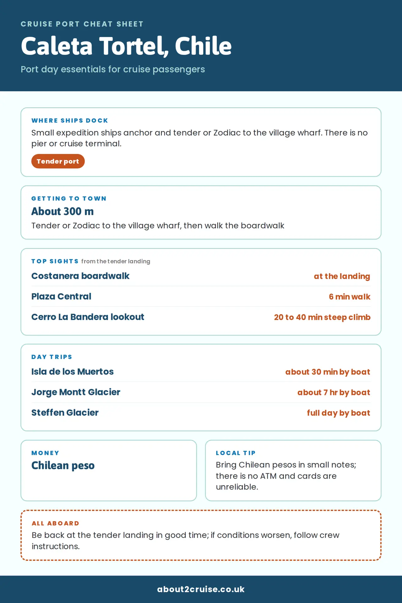
- Port type: Anchor and tender or Zodiac only. No pier, no cruise terminal.
- Currency: Chilean peso; cash is essential.
- ATM and cards: No ATM; card acceptance is unreliable.
- Language: Spanish, with limited tourist English.
- Walking: Free boardwalk network; steep sections and wet wood.
- Accessibility: Limited. The best option is the step-free 1,509 m costanera stretch near the water.
- Weather: Rain can happen in any month; tender or Zodiac landings can be cancelled.
- Health: Rural health post only; no hospital.
- Connectivity: Entel 4G; free Wi-Fi at the public library.
- Best for: Walkers, photographers, expedition cruisers and travellers who prefer place over shops.
- Itinerary fit: If your voyage also includes Puerto Chacabuco, Puerto Montt or Puerto Natales, Caleta Tortel is the rawest and smallest of the group. For the wider picture, see the Chile cruise ports guide.
Why Caleta Tortel Has No Roads (and Why That’s the Point)
Caleta Tortel is famous for what it doesn’t have: no roads, no cars, no traffic lights and no paved streets. Instead, the village is stitched together by roughly 6–7.5 km of raised cypress boardwalks, bridges and staircases that connect houses, jetties, plazas and lookouts above the tide. Locals move only on foot along these pasarelas. Vehicles stop at a car park at the village entrance; after that, the boardwalk is the only road.
The walkways aren’t a theme-park replica. They’re the working circulation system for a small community of a few hundred people who live in stilt houses along the cove. The official heritage route through the village is about 7.3 km and is best treated as a full-day walk if you want to do it calmly.
The Guaitecas Cypress Architecture and Logging History You’ll See Everywhere
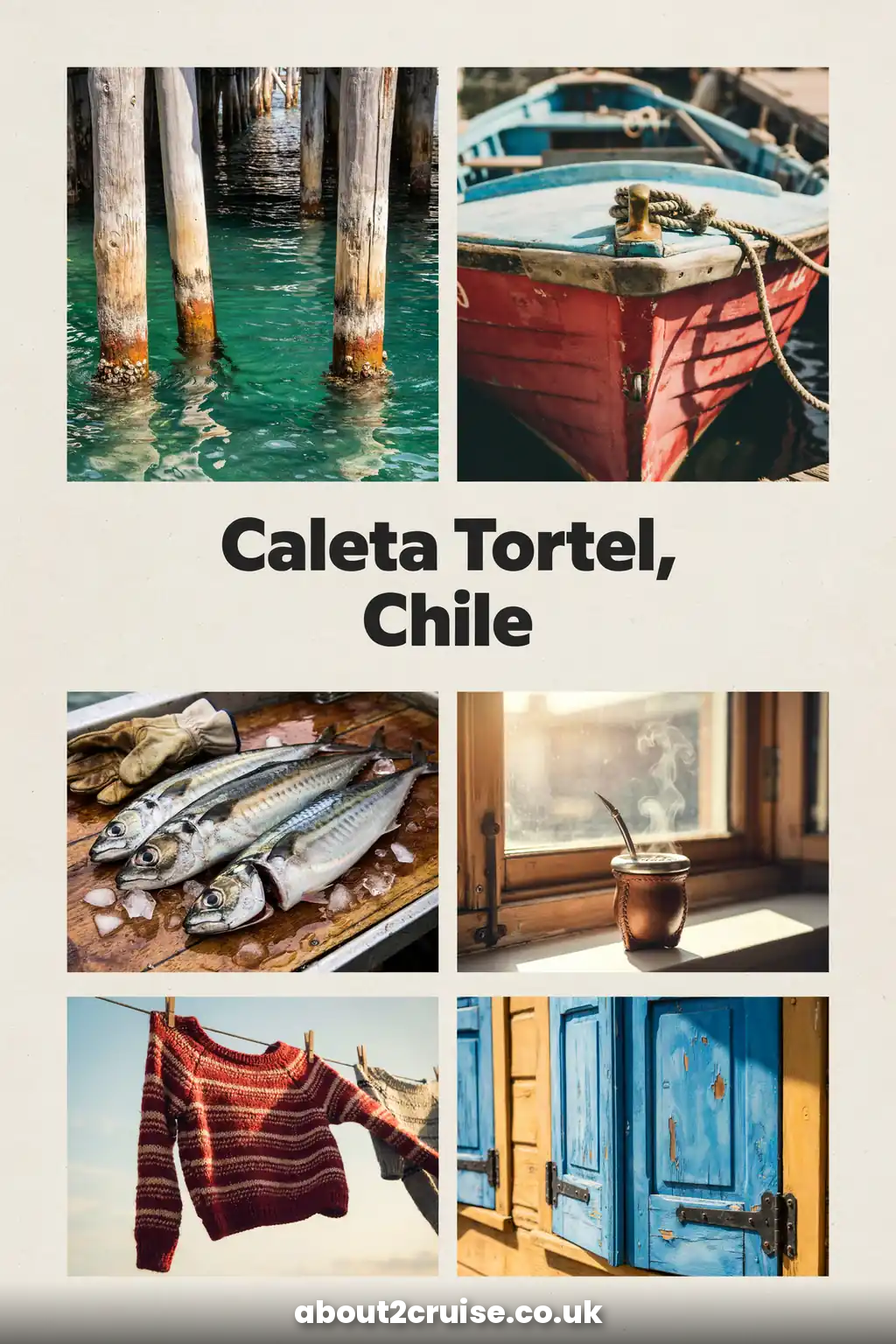
Caleta Tortel grew out of Guaitecas cypress logging, and that timber still defines the place. The wood is naturally rot-resistant and can stay submerged for long periods, which is why it was used for the walkways. Houses are stilt houses in the Chilotan style, many with tejuela shingles, and the walkway construction technique was brought by Chilote loggers and workers on the Baker River.
The village is listed as a Zona Típica, or heritage district, covering the cove’s 80 m strip, piers, boardwalks, houses and hillside vegetation. Local craft skills include tejuela shingle-making and river boatbuilding, both living traditions rather than museum pieces.
Where the Baker River Meets the Fjords: Caleta Tortel’s Setting
Caleta Tortel sits where the Baker River, Chile’s largest river by water volume, meets a small bay of the Baker Channel. The water often has a milky glacial tint, forested slopes rise straight from the fjord, and the delta splits into two arms, of which only the northernmost is navigable. This meeting of river, fjord, island and forest is the landscape you see from the ship before the tender even reaches the wharf.
Gateway to the Northern Patagonian Ice Field and Glacier Country
The village lies between the Northern and Southern Patagonian Ice Fields and is one of the recognised sea gateways to Bernardo O’Higgins National Park, together with Puerto Natales, Puerto Edén and Villa O’Higgins. From Caleta Tortel, small boats can reach the edge of glacier country, including the Jorge Montt Glacier about 30 nautical miles away. Katalalixar National Reserve is also reached by sea from the village. This is not a place you pass through quickly; it is the end of the road before the ice.
What It’s Like to Walk the Pasarelas (Boardwalks) in Caleta Tortel
From the landing you can walk the boardwalks for free. The route passes houses, a school, a church, jetties, small plazas and lookouts. Named sectors include Sector Base around the civic centre and Plaza Central, the costanera boardwalk, Plaza Kawáskar, Plaza Orompello, Rincón Alto, Rincón Bajo, Playa Ancha and Junquillo. A leisurely waterfront walk can take 30 minutes; adding the upper sectors and lookouts can fill several hours.
The town is not large, but it rewards slow walking. You will often see residents carrying groceries, schoolchildren moving between buildings, or someone repairing a section of wood. That is the real attraction: everyday life above the water.
Meeting the People of Caleta Tortel: A Small, Isolated Community
Caleta Tortel is a living village, not a cruise terminal. The standard shore experience offered by some ships is a cultural gathering at the main plaza: folkloric performances, refreshments and local crafters selling cypress-wood carvings. If you arrive independently, you may simply meet people as you pass the school, the library or a small shop.
This is one of the most isolated communities in Chile. People live here all year, and the isolation shapes daily life. Treat the village as you would a small neighbour: ask before photographing people, do not enter private boardwalks or staircases, and accept that opening hours, services and availability are not geared around cruise calls.
Fjord, Waterfall and Glacier Scenery from Ship and Shore
Even before you step ashore, the approach to Caleta Tortel is part of the call. Expedition ships thread through forested channels, past waterfall-covered slopes and into the milky water of the Baker River mouth. Once ashore, the boardwalk lookouts give you the reverse view: the ship at anchor, the fjord, and the green hills rising behind the stilt houses. After rain, temporary waterfalls appear all around. Binoculars are worth the space in your daypack.
Tender Landings and Weather: What to Know Before You Go
Your first practical question is whether your ship actually lands or only cruises by. Most expedition calls are landings, but not every itinerary is identical. A few published calls have very short windows, such as 07:00–13:00, which effectively rules out long boat trips and may reduce time ashore. Always check your cruise line’s excursion list and daily programme.
Tender or Zodiac landings at Caleta Tortel are weather dependent. The bay is often calm because it is protected, but the Baker River mouth and the fjord are exposed to fast-changing weather. If small-boat operations are suspended while you are ashore, stay near the landing point and follow crew instructions. Do not try to swim or wade to the ship. Cancellation is a real possibility, so build flexibility into your plans.
Arriving by Ship: Anchorage, Tender Landing and No Cruise Terminal
Ships anchor in the bay or fjord and run tenders or Zodiacs to the village wharf. The landing is beside the Capitanía de Puerto Baker, the Chilean Navy port captaincy, and the public library. From there you are already on the boardwalk network. The village centre is about 300 m, or roughly six minutes, away on foot along walkways and stairs.
There is no dedicated cruise terminal, no shuttle bus, no taxi rank and no road access. The exact tender crossing time is not published because the anchorage position can vary, but in normal conditions it is a short boat ride inside a sheltered bay. Only small expedition ships can enter Caleta Tortel; large cruise ships cannot call here.
Caleta Tortel cruise port map
Tenders bring you ashore at village wharf (tender landing). From the tender landing, Plaza Orompello is about a 6-minute walk and Costanera boardwalk about 11 minutes. Tap a pin for directions.
- village wharf (tender landing)Where tenders land
- Plaza OrompelloSquare · About 6 min walk from the tender landing
- Costanera boardwalkWaterfront boardwalk · About 11 min walk from the tender landing
- Mirador Caleta TortelViewpoint · About 16 min walk from village wharf (tender landing)
- Isla de los MuertosIsland · About 4 km from the tender landing
- Steffen GlacierGlacier · About 36 km from the tender landing
- Fiordo CalénFjord · About 35 km from village wharf (tender landing)
- Glaciar Jorge MonttGlacier · About 76 km from village wharf (tender landing)
Do You Need a Tour in Caleta Tortel? Ship Excursion vs Walking on Your Own
Caleta Tortel is one of the easiest ports in Chile to do independently. You step off the tender and you are already in the sight. No tour is needed to walk the boardwalks, and the walk is free.
That said, there are two good reasons to join a ship or organised activity. First, some lines include a cultural experience with a folkloric performance and craft stalls at the plaza, which gives you contact with the community that you might otherwise miss. Second, any boat trip, Isla de los Muertos, the glaciers or Baker River navigation, is easiest if arranged through the ship or a pre-booked local operator, because capacity is small and departures are weather dependent.
A licensed local guide for a village boardwalk walk is inexpensive by cruise standards, around CLP 12,000 per person. If you want historical stories and access to local knowledge, that is worth considering. But if your aim is simply to walk, photograph and sit by the fjord, go on your own.
Caleta Tortel Boardwalk Routes, Steps and Realistic Walking Times
The official heritage route through the village is about 7.3 km, with the full circuit best done over a day. The Cerro Vigía circuit needs at least three hours of walking and is best started in the morning. The climb to the flag-hill lookout, Cerro La Bandera, is described as a steep 20–40 minutes, though some route guides treat it as a 2–3 hour walk.
For a cruise call, think in small chunks:
- Waterfront and low boardwalk: 30–60 minutes.
- Village centre, plazas and a viewpoint: 2–3 hours.
- Leisurely exploration including upper sectors: 4–5 hours.
- Full official route: not realistic on a short call, and not necessary to enjoy the place.
There is no published total step count, but expect many steps and changes of level. A newer 1,509 m stretch of the Avenida Costanera boardwalk has been rebuilt 2.45 m wide with double handrails and no steps, built to universal-accessibility standard. The upper sectors are steeper and more exposed.
Mobility and Accessibility on Wet Wooden Boardwalks
Caleta Tortel is difficult for wheelchairs and challenging for many slow walkers. The tender or Zodiac ride itself may be a barrier: some lines state that guests requiring a wheelchair cannot access a Zodiac, and landings can be wet. At the wharf you may meet a floating jetty with several steps before reaching the boardwalk.
The step-free costanera stretch is the realistic accessible option. It is 1,509 m long, 2.45 m wide and has double handrails. If you have limited mobility, stick to this lower route near the water, enjoy the view and do not attempt the steep upper staircases. Walking aids may be usable on the costanera, but not all stretches are smooth, and wet cypress is slippery even when the sun is out.
There is no official section-by-section accessibility guide beyond the rebuilt costanera. If you use a stick or have balance concerns, bring a folding cane or hiking pole with a good ferrule, and watch your step more than the view.
What to Wear for a Wet Patagonian Landing
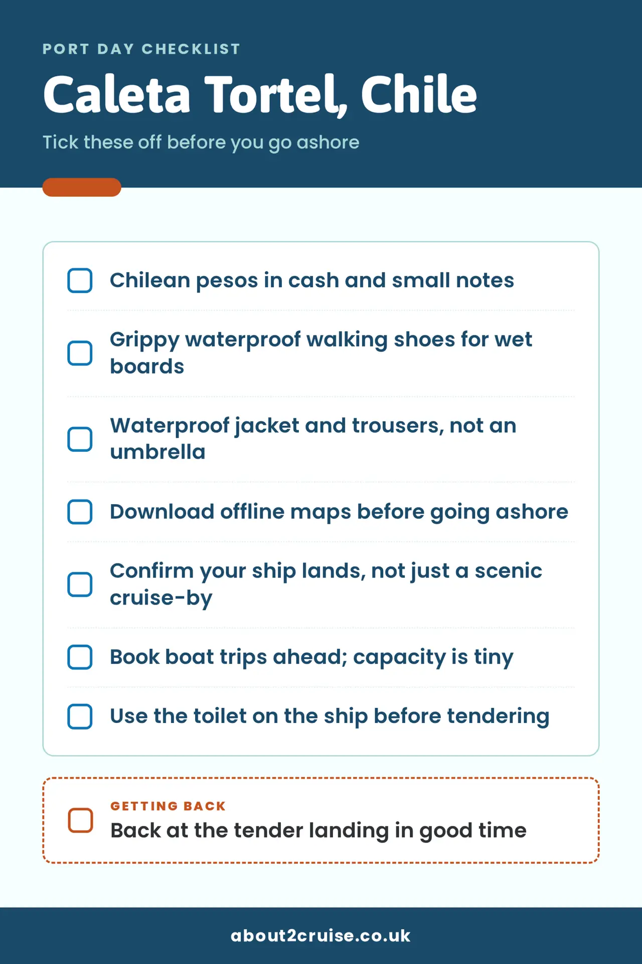
Layered clothing, a windbreaker and good walking shoes are the minimum. Rain is possible at any time of year, and showers can arrive quickly. A waterproof jacket and trousers are more useful than an umbrella, because the wind often makes umbrellas useless.


Footwear is the most important decision. Wet cypress boards are slippery, and some sections are steep stairs. Wear grippy, waterproof walking shoes or light boots. Avoid smooth-soled trainers, sandals and anything you do not want to soak. A small dry bag for electronics is sensible on the tender, and spare socks can make the rest of the day much better.
There is no dress code in the village, but you are in a small, church-going community. Beachwear is not appropriate beyond the shoreline, and warm layers beat fashion here.
Toilets, Shops, Wi-Fi and Other Practical Facilities
Official public toilet provision at the landing is not documented, so assume there is none at the wharf. Use the ship toilet before you go ashore. You may find facilities in cafés or restaurants if you are a customer, but do not count on a clean, obvious public block.
The village has a municipal tourist information office that gives orientation and maps, and around Plaza Central there is a municipal building, a Carabineros post, a public library and a pharmacy counter. Small general stores sell basic goods, but prices are higher than on the mainland because of the isolation.
There is no left-luggage facility at the landing, tourist office or village. Carry only what you want to carry all day, and keep your hands free for handrails on steps.
Money in Caleta Tortel: No ATM, Cash Needed
There is no ATM in Caleta Tortel, and card readers are unreliable. Many small shops, restaurants and boat operators are cash only. Change large Chilean peso notes before you arrive, because small business change may be limited.
Bring enough Chilean pesos to cover your day. For simple walking and a coffee, a few thousand pesos is enough. If you want a local boat trip, a meal and a small souvenir, a realistic cash float is CLP 50,000–80,000 per person. If you plan to take the Isla de los Muertos boat trip independently, have CLP 40,000 or more per person in cash.
US dollars and euros are not the local currency and there is no bank or exchange office to change them.
Mobile Signal, Wi-Fi and Connectivity in Caleta Tortel
Mobile signal at Caleta Tortel is patchy. Entel 4G is the network most likely to work, but other Chilean networks may not. There is free Wi-Fi at the public library, which is the most reliable spot if you want to send a message or upload a photo. Don’t expect streaming, video calls or fast uploads. Download offline maps and any essential documents before you leave the ship.
Language, Etiquette and Being a Respectful Visitor
Spanish is the local language, and English is limited. A few basic phrases help: hola, gracias, por favor, ¿cuánto cuesta? and ‘¿está abierto?’ for shops. Many people in tourism and boat operations will know some English, but a smile and a slow approach work better than expecting service in English.
Caleta Tortel is a small, working community. Stay on public boardwalks, do not enter private raised walkways, and ask before photographing residents. If the ship offers a cultural performance, be present and respectful; applause is welcome, but treat it as a community sharing its place, not a show delivered for your convenience. If you buy from local crafters, pay in cash and don’t haggle hard; the prices reflect genuine isolation and handwork.
Food and Drink in Caleta Tortel: What to Eat and Budget
Local cooking is the best reason to spend a few pesos ashore. The regional dishes to look for are cordero al palo, a spit-roasted lamb cooked over embers for more than two hours, and fresh canal fish such as salmon, conger eel and hake. Shellfish, including centolla and prawns, appears when available. Calafate berries show up in juices, jams and desserts.

Simple set menus or a main dish cost roughly CLP 8,000–14,000; a more elaborate fjord-view restaurant may charge CLP 14,000–22,000 per dish. Opening hours are unreliable, and many places do not take cards. If you have strict dietary requirements or a short port call, bring a snack from the ship and treat anything ashore as a bonus.
Souvenirs and Crafts Worth Bringing Home
Realistic souvenirs are small, handmade and local: Guaitecas cypress carvings, tejuela shingle work, junco weaving and sheep’s-wool crafts. The best chance to see them is at the craft stalls set up during a ship’s included cultural experience, but a few artisans and small shops may be open independently.
Plaza Orompello has carved wood sculptures honouring the pioneer loggers and timber families. Buy what you can carry, and remember that fragile wood and woven pieces are easier to protect in a daypack than in a tender. Cash is expected.
Wildlife Watching Around Caleta Tortel
From the ship and boardwalks, look for seabirds, cormorants, gulls and occasionally condors. The wider area, including Bernardo O’Higgins National Park and Katalalixar National Reserve, supports huemul, sea lions, fur seals, marine otter, penguins, cormorants and pudú, but most of those are not visible from the village itself.
Keep your distance from any wildlife, do not feed animals, and take all litter back to the ship. Open fires are illegal in Chilean national parks outside permitted camping areas. Binoculars and a small camera with a decent zoom are more useful than trying to get close.
Boat Trips from Caleta Tortel: Isla de los Muertos, Glaciers and More
The realistic boat excursions from the village are:
- Isla de los Muertos: about 3 km from the village in the Baker River delta, roughly 30 minutes by local boat. The round trip takes 2.5–3 hours. Reported prices are around CLP 20,000–40,000 per person, but operators charge per departure, so the price falls as the boat fills. This is the best boat trip for a normal six-to-eight-hour port call.
- Jorge Montt Glacier: about 30 nautical miles away, a full-day trip of around 7 hours. Reported prices are CLP 130,000–150,000 per person. This will not fit a short call, and even on a long call you should only attempt it through the ship or a pre-booked reliable operator with a guaranteed return.
- Steffen Glacier: a full-day trip, reported at CLP 90,000–130,000 per person. Also not for short calls.
- Baker River navigation: shorter runs around the river mouth and delta when weather allows.
Hot springs are not a realistic excursion from Caleta Tortel. The thermal complexes in Aysén are far to the north, around Puyuhuapi and the Palena area.
Local boat operators work from the village itself, mainly from Playa Ancha and Base sectors. Capacity is small, departures need minimum numbers, and everything is weather-dependent. If a boat trip matters to you, book it through the ship or contact an operator well in advance.
National Parks, Permits and Protected Areas Nearby
Caleta Tortel is a gateway to protected areas, but access is not a free-for-all. Bernardo O’Higgins National Park, Chile’s largest, has no land access from the Aysén sector; you reach it by navigating from Tortel towards the Jorge Montt Glacier. CONAF Aysén requires prior coordination and authorisation for those trips. Katalalixar National Reserve is also accessed by sea from Caleta Tortel.
Isla de los Muertos is a protected historical monument with a formal boardwalk circuit. If you visit, stay on the path and treat the cemetery with respect. Independent excursions into national park land or ice-field approaches need proper permits; do not assume any local boat can take you anywhere. Book with operators who can explain the authorisation they hold.
Safety, Medical Care and Emergency Limitations
Caleta Tortel is a remote place with limited medical care. The village has a rural health post, Posta de Salud Rural Caleta Tortel. The referral hospital for the commune’s rural posts is at Cochrane, about 126 km away, and the regional high-complexity referral centre is Hospital Regional Coyhaique. A serious injury or illness could involve a long, weather-dependent evacuation.
Take all personal medications, a small first-aid kit and extra supplies of anything you cannot go without. If you have a significant health condition or mobility problem, consider staying on the ship or taking only the easiest lower-costanera walk.
The pickpocketing and street theft reported in bigger Chilean cities is not the main concern here, but do not flash expensive jewellery or large amounts of cash. Keep your bag with you and zip it shut on the tender.
Photography, Drones and Cultural Sensitivity
The classic Caleta Tortel photos are the stilt houses and boardwalks above the water, the costanera, Plaza Kawáskar, the flag-hill lookout over the village and the Baker delta, and the cypress-cross memorial at Isla de los Muertos.

Ask before photographing people, especially children. This is someone’s home, not a rural backdrop. On Isla de los Muertos, the site is an active memorial with 33 marked graves and an unresolved history; keep photography restrained and focus on the setting, not close-up details of the crosses.
Drones are not practical or appropriate here. Chile’s civil aviation authority requires registration, an operating credential and advance authorisation for drone flights, with stricter rules over populated areas. CONAF also prohibits drones in protected areas. Leave the drone on the ship.
Best Time to Visit Caleta Tortel: Weather, Rain and Daylight
Cruise calls cluster between October and March, which is the milder and more stable window for navigation. February is the mildest month, with an average high of 12.7 °C and low of 6.5 °C, but it still records around 14 rain days and 260 mm of rain. November is colder, around 7.9 °C high and 2.7 °C low, and rain is common. There is no dry season.
Daylight is generous in the cruise months. Sunset is around 21:49 in January, 21:08 in February, 20:15 in March, 21:12 in November and 21:49 in December, with up to roughly 16 hours of daylight at midsummer. Even on an overcast day, there is usually enough light to walk. The best advice is to visit in the cruise season and still assume you will get wet.
Getting to Caleta Tortel Without a Cruise Ship
Caleta Tortel is a port of call, not a turnaround port. No cruise starts or ends here. If you arrive independently, the nearest major airport is Balmaceda; from there it is about a 10-hour drive along the Carretera Austral. The village is 462 km south of Coyhaique and about 125 km from Cochrane. A side road leaves the Carretera Austral and ends at the village car park, because no vehicles go further.
Local buses run between Cochrane and Caleta Tortel several times a week, but you need to confirm times and reserve. From the south, the alternative is a ferry from Puerto Natales to Puerto Yungay plus an overland section. Once at the car park, expect a 2–2.5 km walk down steps and boardwalks to the centre. If you stay overnight, book ahead; Entre Hielos is the best-known cypress lodge with fjord views, but the approach includes a long staircase, so call ahead if you need help with bags. Other beds are family guesthouses and simple campsites.
Is Caleta Tortel Worth Visiting on a Cruise?
Yes, if you are on a small expedition ship and you understand what you are getting. Caleta Tortel is one of the most unusual calls in Chile: a roadless cypress-boardwalk village at the mouth of the Baker River, with fjord scenery, living logging heritage and a genuinely isolated community. It is not for shopping, dining, museums or guaranteed comfort.
The payoff is a slow walk through a place that still works as it has for generations, and a view of Patagonia that feels far from cruise infrastructure. The risk is weather: a cancelled landing turns it into a scenic cruise-by, which is still beautiful but not the same. If you want a guaranteed shore day with smooth paths and lots of services, choose Puerto Chacabuco or Puerto Montt. If you want the feeling of being at the end of the road, Caleta Tortel is hard to beat.
How to spend a port day in Caleta Tortel
A port day in Caleta Tortel works best if you pick one: a slow waterfront and village walk on a short call, or add the Cerro La Bandera climb and upper boardwalks on a long call.
Before you sail
- Check your cruise line's excursion list to confirm the ship lands, not just cruises by.
- Book Isla de los Muertos or any glacier boat trip ahead; capacity is tiny.
- Bring Chilean pesos in cash; there is no ATM and many places are cash only.
Short port day: under 6 hours
- On dockingTender to the village wharfSmall expedition ships anchor off the bay and run tenders or Zodiacs to the wooden wharf. You step directly onto the boardwalk network.
- +15 minWalk the Costanera boardwalkFollow the step-free 1,509 m waterfront stretch south from the landing, passing stilt houses and jetties.
- +45 minPlaza KawáskarA small waterfront plaza about 100 m along the boardwalk, with views over the cove and the ship at anchor.
- +1 hrPlaza Central and village centreThe civic heart, about 300 m from the landing. Visit the tourist office for maps and see the public library and craft stalls if open.
- +2 hrsLunch near the waterfrontTry cordero al paloLocal menus around the Sector Centro boardwalks feature cordero al palo, spit-roasted lamb, and canal fish such as hake or conger eel. Cash is expected.
- +3 hrs 30 minReturn along the lower boardwalkFollow the waterfront back towards the wharf. The public library offers free Wi-Fi if you need to check messages.
- All-aboard minus 1 hrBack at the tender landingTender queues can form late in the day. If two tenders leave without you, follow crew instructions.
The time on the map is the whole walk, every stop added together.
Open this walking route in Google Maps
If plans change: If the upper boardwalk sections are closed, the step-free costanera stretch and the public library still make a good port day.
Long port day: 8 hours or more
- On dockingTender to the village wharfGo earlyThe anchorage position can vary, but it is a short ride inside the bay. Board an early tender to make the most of the day.
- +15 minWalk the Costanera boardwalkFollow the step-free 1,509 m waterfront stretch south past stilt houses to Plaza Kawáskar.
- +45 minPlaza Kawáskar and Plaza CentralA small waterfront plaza, then the civic centre about 300 m from the landing. Pick up a map at the tourist office and see craft stalls if open.
- +2 hrs 30 minLunch near the village centreTry cordero al paloSet-menu dining rooms around Sector Centro serve cordero al palo, spit-roasted lamb, and canal fish such as hake or conger eel. Cash is expected.
- +3 hrs 30 minCerro La Bandera lookoutSteep climbA steep 20 to 40 minute climb from the boardwalks leads to the flag-hill viewpoint over the village, the cove and the Baker delta.
- +4 hrs 30 minDescend through upper boardwalk sectorsWalk back down through Rincón Alto or Rincón Bajo, past stilt houses and gardens above the water.
- +5 hrs 30 minReturn along the CostaneraRejoin the lower boardwalk and walk back towards the wharf. The public library near the landing has free Wi-Fi.
The time on the map is the whole walk, every stop added together.
Open this walking route in Google Maps
If plans change: If the steep hill path is closed, swap the lookout for more time on the step-free costanera and the craft stalls at the plaza.
Frequently Asked Questions About Visiting Caleta Tortel
Can I walk around Caleta Tortel from the tender?
Yes. The tender lands at the village wharf and you step directly onto the boardwalk network. The village centre is about 300 m away on foot. No shuttle, taxi or road transport is needed.
Do I need a tour to see Caleta Tortel?
No. Walking the boardwalks is free and easy to do independently. A tour adds cultural context and can include a folkloric performance or a boat trip, but it is not required to see the village.
Are there cars or roads inside Caleta Tortel?
No. All vehicles stop at the village entrance car park. Inside the village, people walk on wooden boardwalks, bridges and staircases. There are no paved streets or traffic.
How many steps and hills are on the boardwalks?
There is no official step count, but expect many steps and level changes. The waterfront costanera has a 1,509 m step-free section with double handrails. The upper sectors and flag-hill lookout involve steep staircases and hills.
Is Caleta Tortel accessible for wheelchairs or limited mobility?
Very limited. The tender or Zodiac landing may not accommodate wheelchairs, and the wharf can involve steps. The step-free costanera stretch is the realistic option. Upper village paths are steep, wet and not accessible.
What should I wear for Caleta Tortel?
Layered clothing, waterproof jacket and trousers, and grippy waterproof footwear. Wet cypress boards are slippery. A small dry bag for electronics and spare socks are useful.
Is there Wi-Fi, mobile signal or an ATM?
There is no ATM. Bring Chilean pesos in cash; cards are unreliable. Entel 4G usually works best, and the public library has free Wi-Fi. Other mobile networks may have no signal.
Can I buy food or souvenirs at the port?
Yes, but options are small and opening hours are uncertain. Local dishes include cordero al palo and canal fish. Souvenirs include cypress carvings, tejuela work and wool crafts. Cash is expected.
How long does a Caleta Tortel port call need?
Allow at least 2–3 hours for the village centre and lower boardwalks; 4–5 hours is comfortable. A six-hour call can include a walk plus an independent village visit, but not a long glacier trip. The full official route is a full day.
What happens if weather prevents landing?
If tender or Zodiac operations are cancelled or suspended, the call becomes a scenic cruise-by or the ship may wait for a weather window. If you are ashore and conditions worsen, stay near the landing point and follow crew instructions. Do not attempt to swim or wade to the ship.
Can I book a glacier trip on a cruise day?
Only on a long call and preferably through the ship or a pre-booked operator with a guaranteed return. The Jorge Montt Glacier trip is about 7 hours and weather dependent; it will not fit a typical 5–7 hour call.
Is there anywhere to store luggage?
No. There is no left-luggage facility at the landing, tourist office or village. Carry only what you need for the day.