
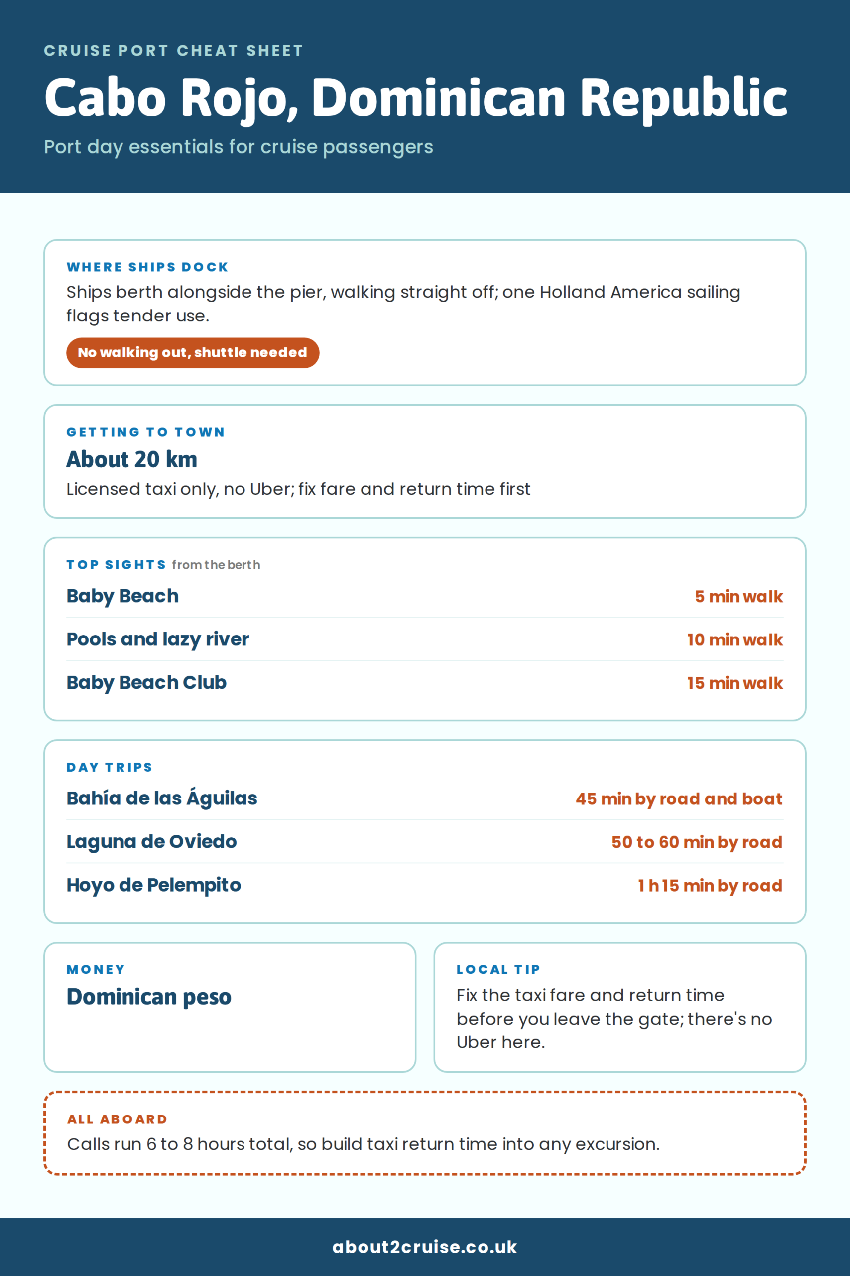
Cabo Rojo cruise port is on the Dominican Republic’s remote south-west coast, where ships tie up alongside a purpose-built terminal with pools, a lazy river, shops and a small beach a few minutes from the gangway. There’s no town at the gate. Pedernales is 20 to 30 minutes by road, and Bahía de las Águilas is the trip to book.
Where Cabo Rojo cruise port is
Port Cabo Rojo sits at the far south-western tip of the Dominican Republic, in Pedernales province near the Haitian border, on Hispaniola, the island it shares with Haiti. Pedernales itself, the provincial capital and the closest town, is 20 to 30 minutes north by road. The port stands on its own, with Jaragua National Park running along the coast beside it.
That isolation is most of the appeal. Most Caribbean cruise port guides describe a pier with a town attached. This one has a national park behind it instead.
| Detail | Cabo Rojo cruise port |
|---|---|
| Country | Dominican Republic, on Hispaniola |
| Province | Pedernales, south-west coast near the Haitian border |
| Berth type | Alongside at a purpose-built pier, no tender in normal use |
| Nearest town | Pedernales, 20 to 22 km, 20 to 30 minutes by road |
| Signature trip | Bahía de las Águilas, 8 km of beach inside Jaragua National Park |
Not the Cabo Rojo in Puerto Rico. Puerto Rico has its own Cabo Rojo, a cape and municipality on that island’s south-west tip with the Los Morrillos lighthouse, and Mexico has a third in Veracruz. If your map search lands you somewhere with a lighthouse and no national park, you’re on the wrong island.
Berthing at Cabo Rojo: alongside, with one tender flag to check
Ships tie up alongside at Port Cabo Rojo rather than anchoring, and the pier’s 40-metre water depth lets the biggest ships come straight in. Oasis-class vessels have docked here, and two can be alongside at once. You walk off the pier into the port complex, no tender ride in normal operation, and nothing starts or ends here: every call is part of a longer itinerary.
One thing to flag. Holland America’s itinerary page for a Zuiderdam call at Cabo Rojo lists a tender and limited wheelchair access, which doesn’t match the walk-straight-off picture. If you’re on a Holland America sailing that stops here and mobility matters for your day, check your boarding documents before you plan anything.

Cabo Rojo cruise port map
The map shows Cabo Rojo and the places worth seeing. Tap a pin for directions.
- Cabo RojoTown centre
- Bahía de las ÁguilasBeach
- La Cueva boat landingBoat landing
- Laguna de OviedoLagoon
- Hoyo de PelempitoViewpoint
- Pedernales townTown
- Parque Nacional JaraguaNational park
- Playa PedernalesBeach
- Alto Velo Island viewpointViewpoint
- Parque Nacional Sierra de BahorucoNational park
- Barahona townTown
- Larimar MinesMines
- Playa San RafaelBeach
- Aeropuerto Internacional María MontezAirport
- Las SalinasSalt flats
Inside the port gates: free pools, a lazy river and Baby Beach
The port complex is the day out, and everything in it is a short, level walk from the berth. A full circuit takes 30 to 60 minutes.
- Pools and a lazy river, free to use.
- A Ferris wheel, a carousel and a mining-themed streetscape, a nod to the bauxite terminal that stood here before.
- A spa, an ATV track, restaurants, bars and souvenir shops.
- Baby Beach, a sheltered cove immediately next to the terminal, with a swim and snorkel cove alongside.
Baby Beach Club, at the far end of the complex, is gated and ticketed, so ask at the gate what the ticket covers before you assume a lounger comes with it. Baby Beach itself is small. When a big ship is in it fills fast, so walk over early.
Ship excursions use the same coast: a glass-bottom kayak trip that finishes at Baby Beach Club, and a scenic drive with a beach stop and a photo pause at the painted sign in Pedernales town.
Getting out of the port: taxis, no Uber and the distances
There’s no Uber in this part of the Dominican Republic and no town within walking distance, so anything past the gates starts with a licensed taxi from the terminal or a tour you’ve booked. Fix the fare and the return time before you set off, and take the driver’s number if you can.
Calls tend to run 07:00 to 16:00, 08:00 to 16:00, 09:00 to 17:00 or 11:00 to 18:00, which leaves a usable window of roughly six to eight hours once you’ve allowed for the walk off and the time you have to be back on board.
- Pedernales town: 20 to 22 km, 20 to 30 minutes by taxi.
- La Cueva boat landing for Bahía de las Águilas: about 9 km, then the boat.
- Hoyo de Pelempito: about 45 km, 1 h 15 min on a mountain road.
- Laguna de Oviedo: about 50 km east, 50 to 60 minutes.
- Barahona, the nearest city of any size: 122 km, 1.5 to 2 hours.
Public transport won’t carry a short call and no scheduled coach serves the terminal, so going independent means a car, a private transfer or a tour vehicle arranged before you sail.
Bahía de las Águilas: the 8 km beach that justifies the call
Bahía de las Águilas is 8 km of undeveloped white sand inside Jaragua National Park, with no facilities on the beach at all. The usual route is a 25-minute drive to the La Cueva fishing village, then a 15 to 20 minute boat across the bay.
Allow four to six hours door to door. Crossings depend on the weather and the sea state, and they do get cancelled, which is why some ship tours go by road to Arandonga Beach near the bay instead of by boat.
Book through your cruise line or a local operator before you sail: there’s no park ticket office at the beach to turn up at, and Cabo Rojo shore excursions and tours are worth securing in advance.
Laguna de Oviedo: flamingos, iguanas and water saltier than the sea
Laguna de Oviedo is a hypersaline lagoon inside Jaragua National Park, around three times saltier than the sea, with flamingos, endemic iguanas and birdlife seen from small shaded boats. It sits 50 to 60 minutes by road from the port and a typical outing runs five to seven hours, so it only fits the longest calls.
Hoyo de Pelempito: a mountain viewpoint that takes most of a port day
Hoyo de Pelempito looks over a deep geological depression in Sierra de Bahoruco National Park, and the climb is half the trip: the road rises about 32 km from sea level through dry forest, pine forest and then cloud forest. It’s about 45 km from the port, 1 h 15 min to 1 h 30 min each way, with uneven walkways that rule it out for anyone with limited mobility. Allow four to five hours round trip at the very least.
Is Cabo Rojo, Dominican Republic safe?
Cabo Rojo is safe enough inside the port, where the ground is level and the complex is managed, so the practical risks sit outside the gates, on the road, in the water and out at the remote edges of the national park. The Foreign, Commonwealth and Development Office rates the Dominican Republic’s crime rate as high, from bag-snatching to violent crime and carjacking, and advises avoiding remote areas after dark and keeping phones out of sight.
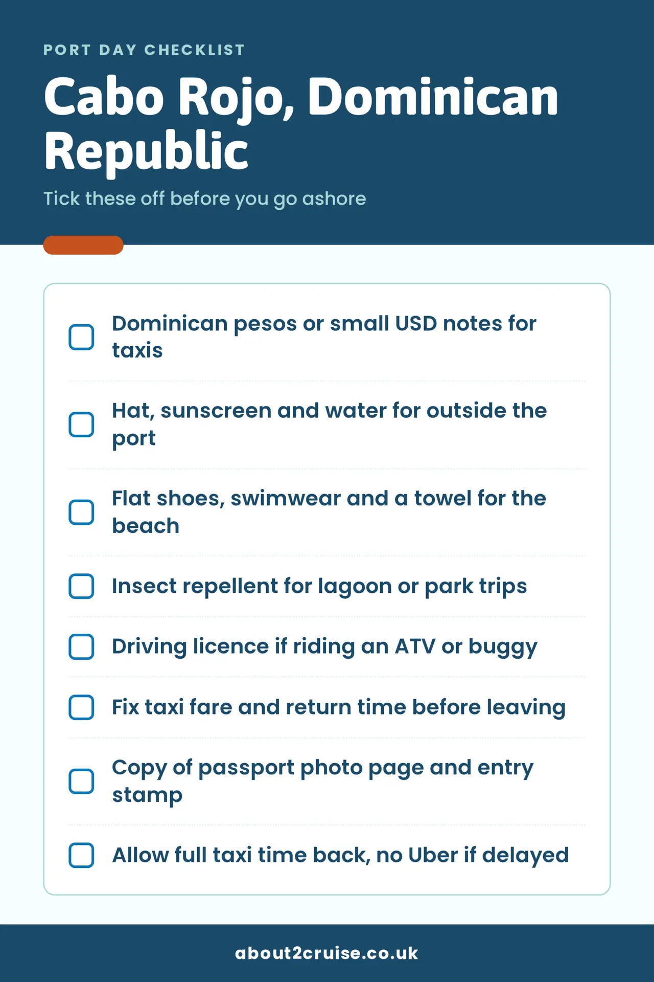
- Carry a copy of your passport photo page and entry stamp.
- Use authorised taxis; motorbike taxis are unsafe.
- Roads carry a high accident death rate, with poor vehicle condition, drink driving and dangerous driving common outside cities at night.
- Lifeguards may not be present at pools or beaches, and rescue equipment may not be available.
- Water sports, boat tours and quad biking may not meet UK safety standards, so check the operator and your insurance before you book.
Where to eat near Cabo Rojo cruise port
The dish to look for near Cabo Rojo cruise port is pulpo a la criolla, reef octopus grilled with criollo sauce or a garlic vinaigrette, and Calle Libertad, the main street of Pedernales town, 20 to 30 minutes from the ship, is where you’ll find it. Seafood is the local speciality, with lobster and lambi, or conch, fished commercially out of Pedernales.

- Pulpo a la criolla. Octopus, grilled and dressed with criollo sauce or garlic vinaigrette, the dish this coast is known for. Look for it along Calle Libertad.
- Lambi (conch). Usually stewed or grilled, and the safest order in the small eateries around Pedernales’ central park and malecón.
- A typical Dominican lunch. Rice, beans, meat and plantain, the set meal included on most local operator tours; on a boat trip to Bahía de las Águilas it’s often the only food within reach.
- Port-side snacks and drinks. Bars, restaurants and snack bars inside the complex, a short walk from the berth and priced for cruise passengers.
Money, Wi-Fi and language at Cabo Rojo cruise port
The Dominican peso is the currency, but US dollars are widely accepted inside the port; change usually comes back in pesos, so carry small notes. Outside the gates cash matters more than cards, and remote places may not take cards at all.
Free Wi-Fi covers the terminal building and stops at the door, so download anything you need before you leave the ship. Spanish is the language, English is spoken in the port area and on tours, and past the port the English runs out quickly.
Weather in Cabo Rojo for a cruise port day
It’s hot and sunny on almost any call, with daytime highs usually in the low-to-mid 30s°C and overnight lows rarely below 19°C. June to September is the hottest stretch, and December to March is the mildest, though mild here still means warm. The wet season runs roughly April to November, so afternoon showers are more likely on calls in that window. January to March tends to be drier. Humidity is high for most of the year, and the UV index sits at 8 or 9 for much of it, so the sun is strong even on a cloudy morning. The Caribbean hurricane season runs June to November, and the sea can be rougher then, which is one reason boat crossings to Bahía de las Águilas sometimes get cancelled.
What to wear in Cabo Rojo: outfit ideas for a port day
Dress for hard sun and almost no shade, and for ground that runs from level paving inside the port to uneven forest walkways outside it.


- A hat, sunglasses, sunscreen and water for anything beyond the port, where shade is scarce.
- Flat, comfortable walking shoes for excursions, plus swimwear, water-friendly footwear and a towel for beach and kayak trips.
- Closed shoes and a physical driving licence if you plan to drive a buggy or ATV around the old mine tracks: operators require both.
- Insect repellent for the lagoon and the national park.
- Reef-safe practice: don’t apply sunscreen before snorkelling, to protect the reef. Pack reef-safe sunscreen for the rest of the day.
For more inspiration, see these Caribbean cruise outfit ideas.
Best photo spots in Cabo Rojo
The red cliffs and rust-coloured earth around Cabo Rojo beach are the signature shot, best in early morning light or from mid-afternoon onwards, with sunset the strongest of the day.
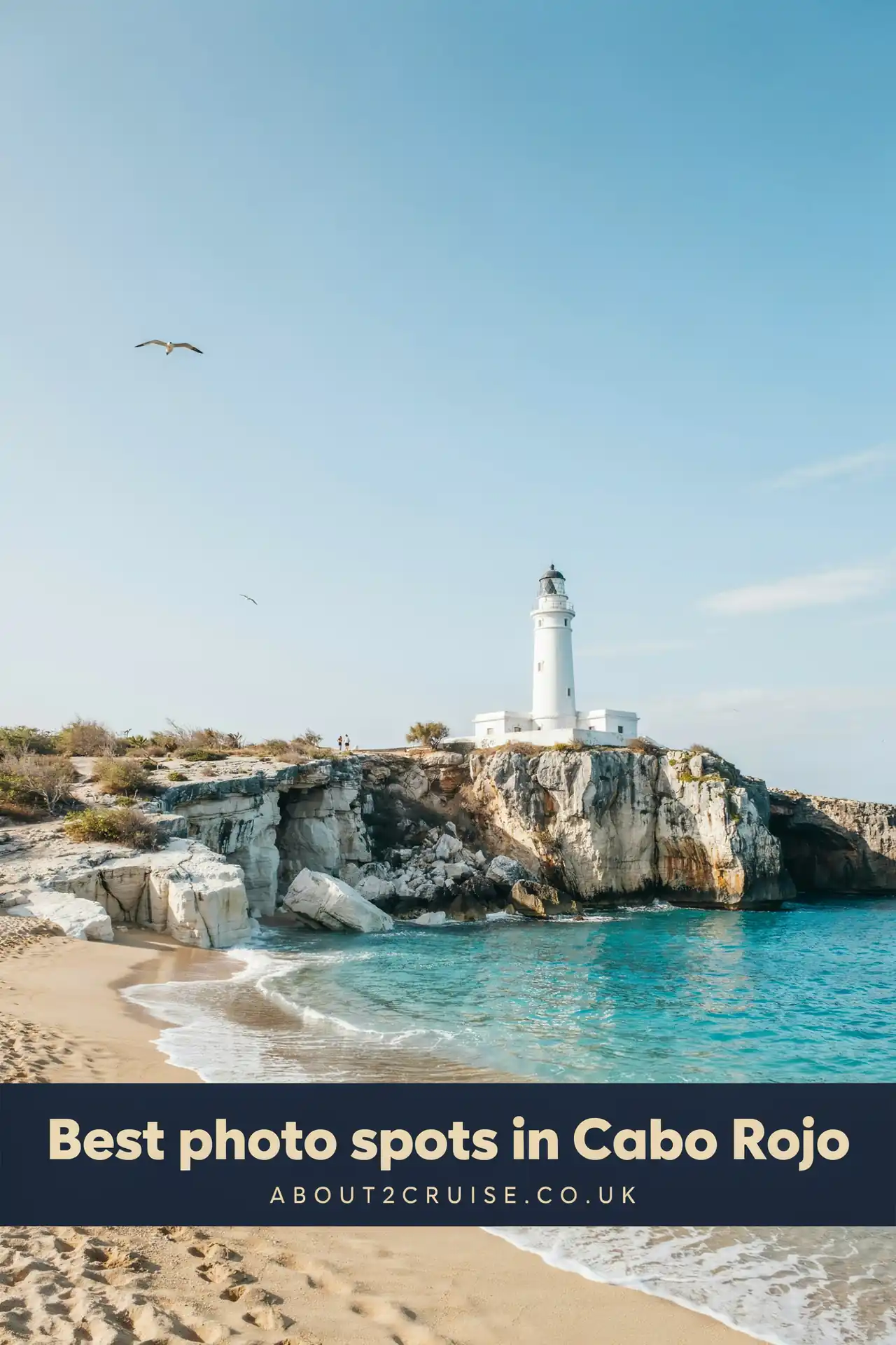
- The red cliffs above Cabo Rojo beach. Bauxite-red earth over blue water; early or late beats the middle of the day.
- Bahía de las Águilas. The 8 km white-sand arc, plus the La Cueva fishing village and boat landing where crossings start. Bahía de las Águilas photos show what to aim for.
- Laguna de Oviedo from a boat. Mangroves, cacti, rocky islets, flamingos and iguanas, among the most photogenic scenery in the country.
- The painted sign in Pedernales. The town’s welcome sign is a scheduled photo stop on ship excursions and an easy shot if you take a taxi in.
How to spend a port day in Cabo Rojo
A port day in Cabo Rojo works best if you pick one: stay in the port complex and visit Pedernales, or book the boat trip to Bahía de las Águilas.
Before you sail
- Book a Bahía de las Águilas tour before you sail; there's no ticket office at the beach.
- Check your boarding documents if sailing with Holland America; one itinerary flags tender use.
- Download anything you need offline, Wi-Fi only covers the terminal building.
Short port day: under 6 hours
- On dockingWalk off the pierNo tender normallyShips dock alongside at Cabo Rojo, so you walk straight into the port complex with no shuttle or tender.
- +20 minPools and lazy riverFree to useA short, level walk from the berth. The free pools and lazy river fill an easy hour.
- +1 hr 15 minBaby BeachThe sheltered cove next to the terminal gets busy once a big ship is in, so go before midday.
- +2 hrsTaxi to PedernalesFix fare first20 to 30 minutes by road. Agree the fare and return time, then look for pulpo a la criolla, grilled octopus, along Calle Libertad.
- +3 hrs 15 minPainted sign and malecónA quick look at Pedernales' painted welcome sign and waterfront malecón, then the same taxi back to the port.
- All-aboard minus 1 hrBack through the gateAllow the full taxi return time plus a buffer; there's no Uber here if you're delayed.
This map shows the taxi ride from the ship. The time is the drive only, not your time ashore.
Open the taxi route in Google Maps
If plans change: If the taxi to Pedernales isn't available, stay in the port: the pools, lazy river and Baby Beach fill a full afternoon.
Long port day: 8 hours or more
- On dockingMeet your booked excursionBook aheadBahía de las Águilas has no ticket office at the beach, so book the tour through your cruise line or a local operator before you sail.
- +30 minDrive to La CuevaAbout a 25 minute drive along the coast to the fishing village and boat landing.
- +1 hrBoat to Bahía de las ÁguilasA 15 to 20 minute crossing to the 8 km white sand beach inside Jaragua National Park.
- +1 hr 30 minBeach timeNo facilitiesThere are no facilities on this undeveloped beach, so bring your own water and shade.
- +3 hrsLunch on the tourMost operators include a typical Dominican lunch of rice, beans, meat and plantain, often the only food out here.
- +5 hrs 30 minBoat and drive back to the portRetrace the crossing and coastal drive, then cool off in the free pools or Baby Beach before heading back.
- All-aboard minus 1 hrBack on boardCrossings depend on sea conditions, so build in a buffer in case the boat runs late.
This map shows the taxi ride from the ship. The time is the drive only, not your time ashore.
Open the taxi route in Google Maps
If plans change: If the boat crossing is cancelled for sea conditions, tours switch to a road trip to Arandonga Beach near the bay instead.
Cabo Rojo cruise port FAQs
Is Cabo Rojo cruise port accessible for wheelchair users?
The port complex is level and paved, so the pools and Baby Beach work on wheels. The walk from the ship to the gate is short, but ask your cruise line about assistance if you need it, since several Norwegian shore excursions do not allow mobility aids.
Can you stay overnight near Cabo Rojo cruise port?
There’s no hotel at the terminal or beside it. An Iberostar of around 580 rooms is due to open, with a Secrets Hyatt and a Dreams Hyatt to follow; until then the beds are small guesthouses in Pedernales town, 20 to 30 minutes away.
Which airport is closest to Cabo Rojo cruise port?
Barahona’s María Montez airport is the closest, about 122 km away, 1.5 to 2 hours by road. Santo Domingo Las Américas is 310 km away. A new Cabo Rojo international airport at Oviedo, 22 minutes from the port, is under construction.
Can you get to Santo Domingo from Cabo Rojo on a port day?
Santo Domingo is five to six hours by road each way, which swallows the whole call. Keep it for an itinerary that docks there, covered in the Santo Domingo cruise port guide, and give Cabo Rojo’s own day to Bahía de las Águilas.
Last Updated: 14 November 2026